
-
TPS coefficients allow to define parameters for the reduction of the distances measured with the total station to the sea level and at the cartographic plane.
-
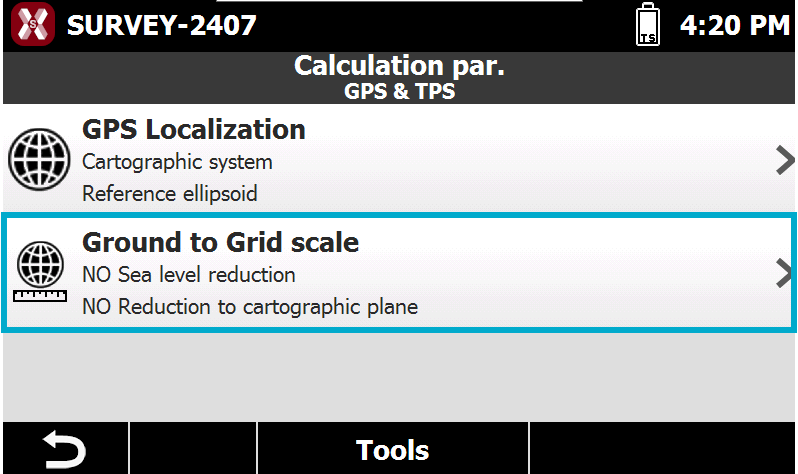
To change the parameters from the Job page select Coordinate systems.
-
Select Ground to Grid scale.
-
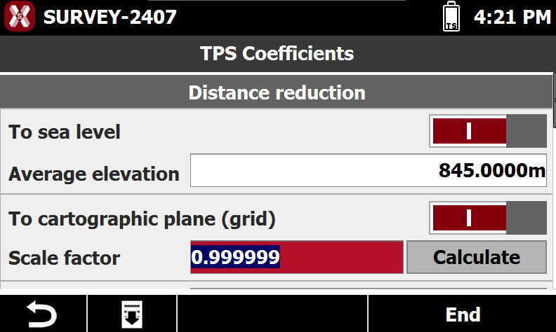
The page allows to change different parameters to reduce measured distances.
-
To sea level: applies the reduction of distances to sea level based on the defined average elevation.
-
Average elevation: specifies the average elevation used to calculate the reduction of distances to sea level.
-
To cartographic plane (grid): applies the reduction of distances to the cartographic plane.
-
Scale factor: specifies the scale factor used for reduction to the cartographic plane. The scale factor can be defined within the selected cartographic system. Press Calculate to enter or select from point list the east and north coordinate for the reference point to calculate the scale factor.
-
Combined scale: the field displays the combined scale factor depending on the calculated elevation and cartographic scale factor.
-